Citywide street cross-section analysis: a multi-scale approach
Nicolas Palominos, Doctoral Researcher
The Bartlett Centre for Advanced Spatial Analysis (CASA)
Jan 2019
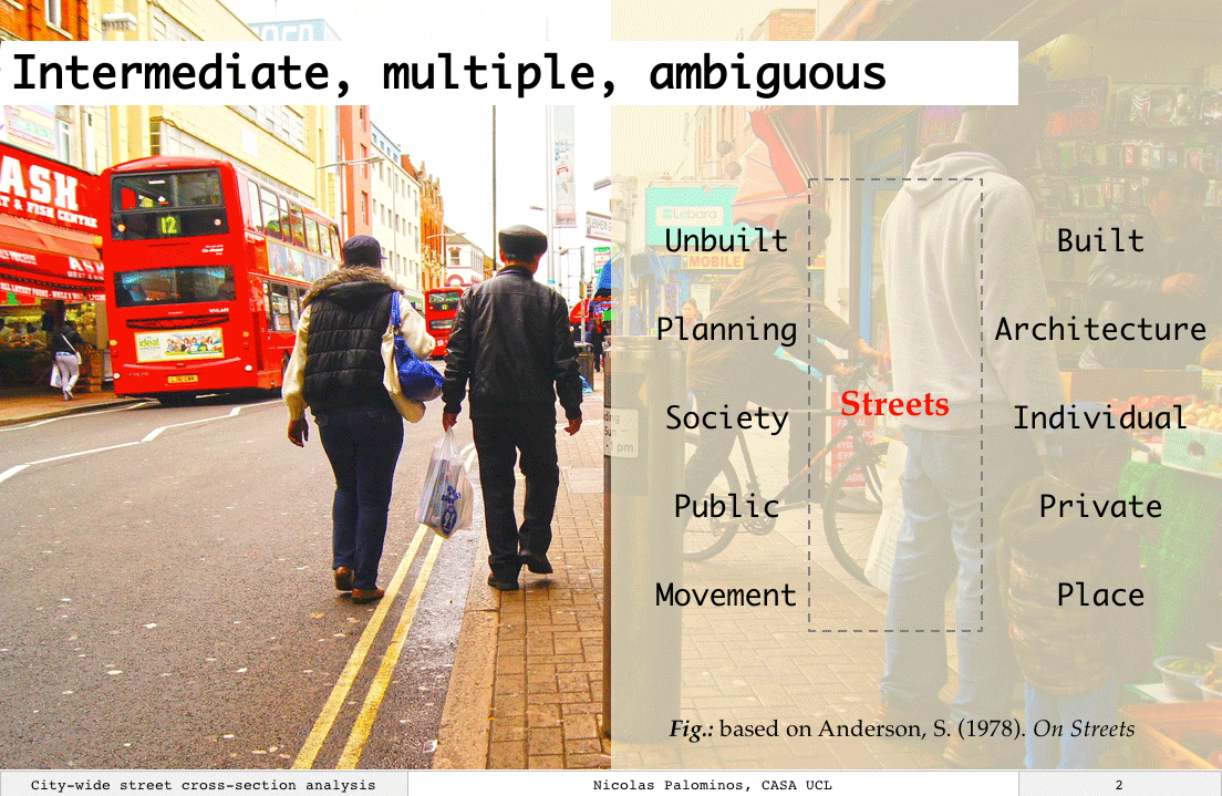
Streets are a complex overlay of systems at an intermediate position in the built environment
1 Introduction
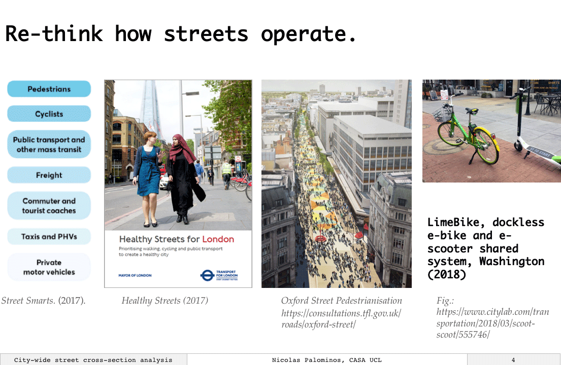
Streets are the main physical mean through which the components of a city are connected together. These connections are physically demarcated by the designation of space for pedestrians and vehicles. Both spaces complement with each other to fulfil the various roles of streets at the design and strategic scales of the city. But this complementary relationship also implies a dispute for space.
City growth and emerging mobility behaviours make evident the design problem of street space designation. Particularly for enduring street patterns where street space is often fixed and limited. Furthermore, modernist design-principles prioritized car-traffic over other street uses.
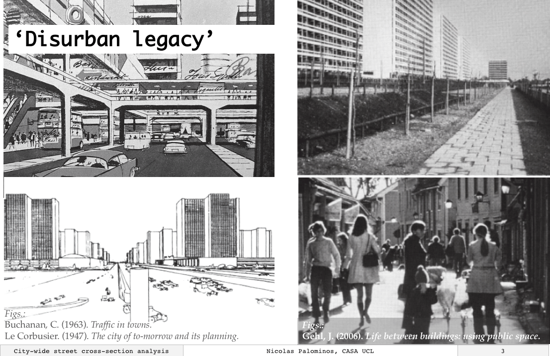
‘Disurban legacy’: distorted relation between roads and buildings with a negative impact on the urban fabric.
2 Analysis
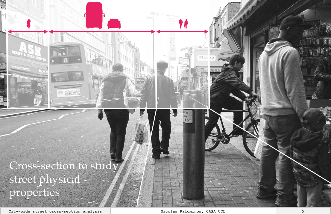
Street cross-section: The space of the street is decomposed into the pedestrian and vehicular system
Through a cross-section analysis, all streets in a city are decomposed into the vehicular and pedestrian subsystems to quantify their physical relation. New data was generated for over 200,000 street segments in London using experimental geocomputational techniques to get quantitative descriptors: footway, carriageway and total street widths.
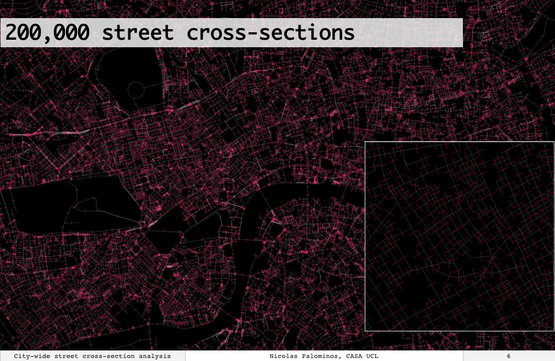
London citywide street cross-section analysis
A systematic analysis that combines these measures with the analysis of the street network makes it possible to respond to important questions in new ways. How are streets described in terms of their space designation and structural properties? How do these streets metrics spatially organize across the city? What correspondence do these properties have with urban form?
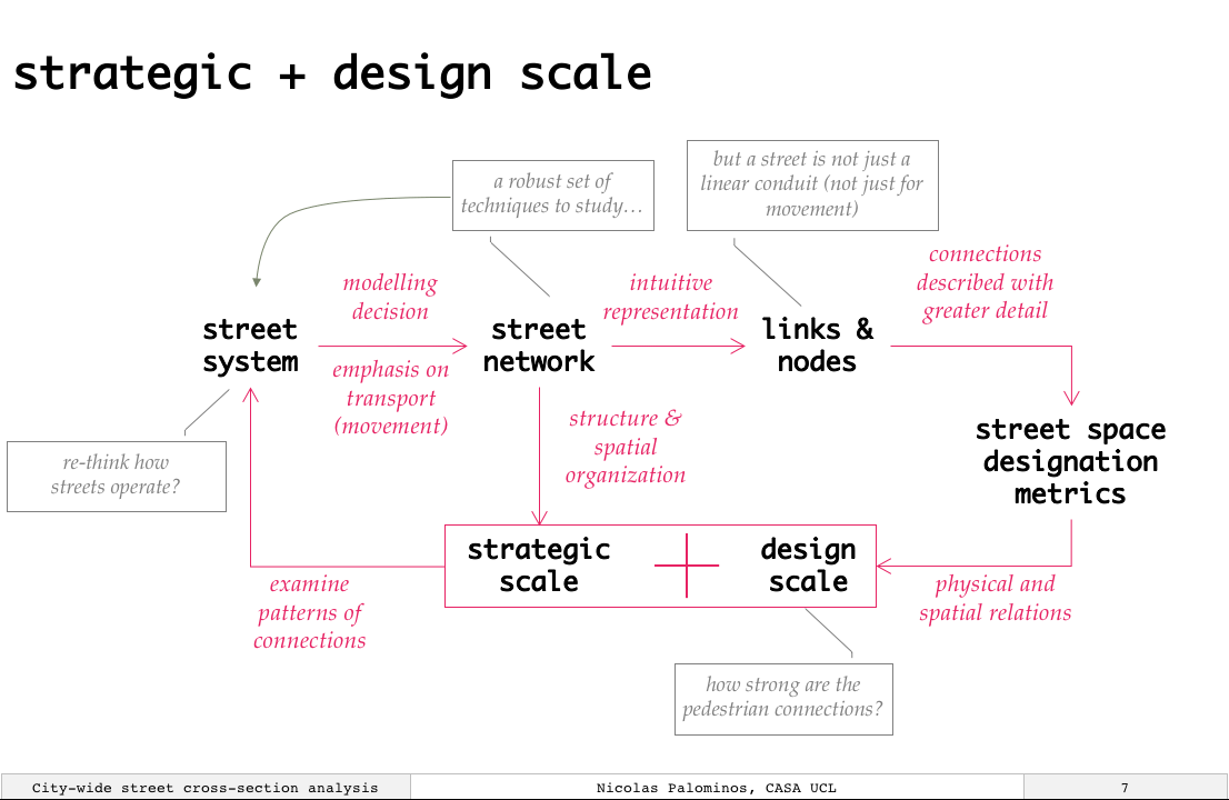
Simultaneous attention to the design and strategic scales of street systems for street planning and design
The novel descriptive analysis of street cross-section measures shows that the typical street segment in London has 7.5m carriageway and 4.5m footway space. This implies a dominance of the vehicular space in the design of London streets. It is also observed that London has a wide range of street types which can be interpreted as both variations of streets standards through time and the different roles that streets serve in cities.
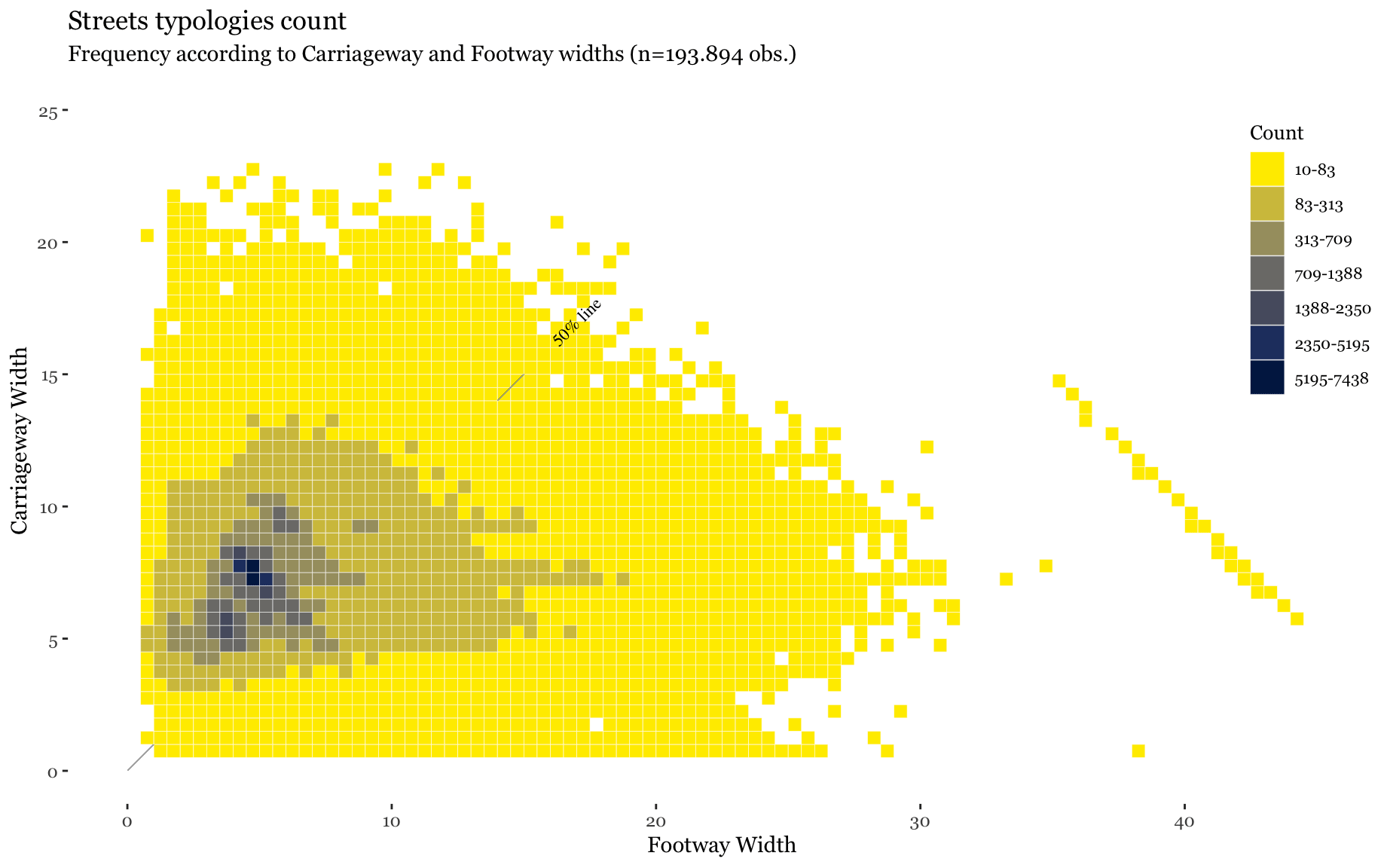
London streets designate more space for carrriageways than footways
3 Conclusion
Initial findings suggest that existing street typologies might be refined to support alternative methods for street planning and design that are consistent with current patterns of urbanization and emergent mobility practices.
Citywide street cross-section offers an alternative method for street planning and design that is sensible with current urban transformations and emergent mobility practices
4 References
Anderson, Stanford (1978). On streets / edited by Stanford Anderson / for the Institute for Architecture and Urban Studies. Cambridge, Mass. ; London: MITPress. isbn: 978-0-262-01036-8.
Buchanan, Colin (1963). ‘Traffic in towns’.
Gehl, Jan (2006). Life between buildings: using public space / Jan Gehl ; translated by Jo Koch. 6th ed. Copenhagen: Danish Architectural Press. 200 pp. isbn: 978-87-7407-360-4.
Le Corbusier (1947). The city of to-morrow and its planning / by Le Corbusier / translated from the 8th French edition of Urbanisme by Frederick Etchells. In collab. with Frederick Etchells. London: Architec- tural Press.
Transport for London. The Mayor’s Transport Strategy. Transport for London. url: https://www.tfl.gov.uk/corporate/about- tfl/how-we-work/planning-for-the-future/the-mayors- transport-strategy (visited on 08/12/2017).