Nicolas Palominos

Researcher in Spatial Analysis & Urban Design, City Designer, Architect

Nicolas is an Architect, City Designer and Spatial Analyst trained in Chile and the UK. His multidisciplinary career includes practising in a range of projects from designing buildings and city interventions, to Urban Design research, to Urban Design and Planning advisory in the public, private and academic sectors. His unique experience bridges urban design with a quantitative understanding of cities. Nicolas is especially interested in the potential of urban data for the creative and strategic spatial analysis of urban systems to inform sustainable urban design and city planning. He tweets at npalomin and micro-blogs on urban data science at urban data notebook. A 2 pages CV is available here. Google Scholar

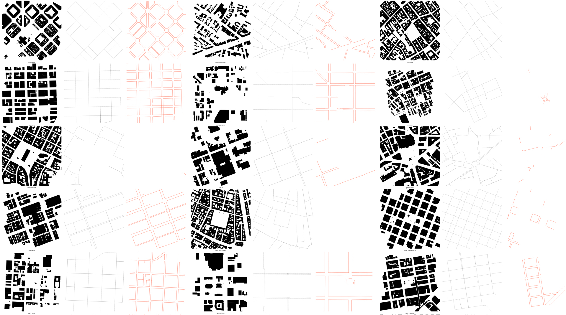
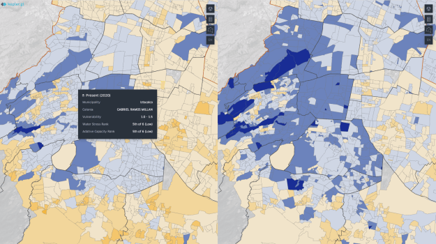
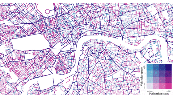
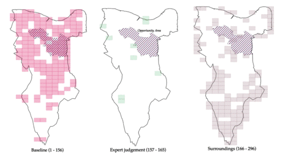
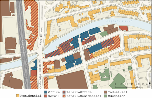
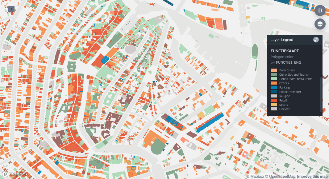
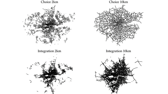
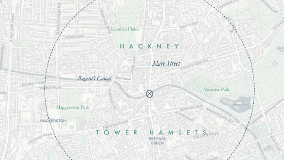
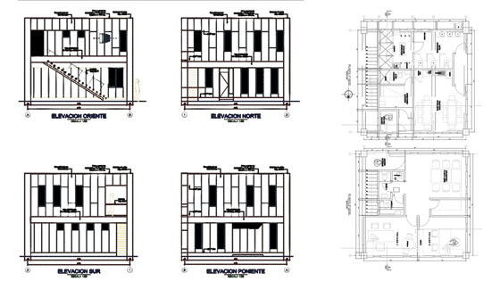
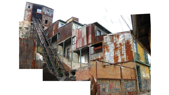
This webpage is a visual portfolio of his most recent works on urban data science, urban planning and urban design research.

Slide-deck in english. En español (metodos y herramientas).


Measuring the space between buildings through OpenStreetMap data

Research Centre for Advanced Spatial Analysis 2022

Extracting OSM data from 117 worldwide cities and comparing to alternative data sources we highlight how the OSM data model could be used to support the collection and analysis of streetspace data (in co-authorship with O. Sargoni and H. Gumble)

See poster presented at the 30th Annual Geographical Information Science Research UK (GISRUK), Liverpool, United Kingdom, 5th – 8th April 2022. Poster, Abstract.


Tranquil City Index study for the Glasgow city region

Practice/Research Nicolas Palominos 2022

Worldwide Database Creation Model. Data Gathering Automation Work Packages and Interactive mapping

See blogpost by TranquilCity


Socio-hydrological resilience in Mexico City

Practice/Research Centre for Advanced Spatial Analysis 2019

A tool for assessing the socio-hydrological resilience of cities that allows decision makers to assess the impact of changing water-management practices (in collab. with BGS and AA)

See the “Socio Hydrological Resilience in Mexico City and Metropolitan Area” project’s website

Standalone website with matrix for comparing scenarios

Webapp for interactive exploration of socio-hydrological scenarios and impact assessment (url)


Healthy Streets Index

Practice/Research Nicolas Palominos 2019-

A spatial dataset that scores every street in relation to the Healthy Streets Indicators using a composite of key city-wide datasets (in collab. with A. Dhanani, Healthy Streets and TranquilCity)

See UCL News press release

Related work on COVID-19: streetspace for social distancing and cycling infrastructure


Underscore streets a research and practice collaboration that explores the role of streets in creating sustainable and healthy urban environments


Rethinking streets

Academic/Thesis/Publication Centre for Advanced Spatial Analysis 2016/21 PhD research examining the relationships between streetspace allocation metrics and urban structure: Rethinking Streets: a study of streetspace allocation metrics and street networks in London CASA Working Papers Series 222 “Identifying and Characterising Active Travel Corridors for London in Response to COVID-19 Using Shortest Path and Streetspace Analysis”. Developed into book chapter

CASA Working Papers Series 212 “Quantifying and Mapping Streetspace: a Geocomputational Method for the Citywide Analysis of Pedestrian and Vehicular Streetspace”

Conference presentation at the 3rd INTERNATIONAL LAND USE SYMPOSIUM. Land use changes: Trends and projections. | Download poster presented at the London Walking and Cycling conference 2019.| PhD Bartlett Conference 2019 presentation and conference abstracts booklet.

See paper presented at the ‘UrbanSys 2018: Transport, Smart Cities, Complexity and Urban Networks Conference’ and the Geodesign South America 2017 conference paper.

Streetspace for active travel media appearance


Southwark Industrial Audit

Academic/Research The Sir John Cass School of Architecture (Cass Cities) 2019 Technical development of a comprehensive field-survey of industrial activities in the borough of Southwark Survey technical specifications and methodology
See interactive map with results in beta version


Vyner Street, Hackney; Mix of Uses

Academic/Research 2019 Land use mapping of Vyner Street mixed use area in Hackney included in the book Working Cities Architecture, Place and Production, by Howard Davis, 2019. Book excerpt

Hi-res map


Mix-use Amsterdam, non-residential functions

Academic/Research 2019 Urban morphology mapping study of functions(12 classes) using open data and the kepler.gl platform - full screen interactive map Open geodata source

Hull maps (colour palette reference)


Planning Urban Manufacturing

Academic/Research Bartlett School of Planning and School of Architecture UCL 2019 Project examining the geography of urban manufacturing in London and its relation to mixed-use urban developments. Paper presented at GISRUK 2020 Visualising manufacturing activity in London


London Manufacturing Profiler

Academic/Research Bartlett School of Planning and School of Architecture UCL 2018 Part of the ‘Planning Urban Manufacture’ project this visualisation tool combines manufacturing indicators with street accesibility measures.

See minisite with data analysis and complete map matrix


Cities of Making

Academic/Research Circular Economy Lab UCL 2018 Project exploring the future of urban manufacturing in Europe with the focus on three cities: London, Brussels and Rotterdam. Case study on the ‘Maker Mile’ area in Hackney. See project website Maker Mile case study report


Street Anatomy Santiago

Academic/Research Centre for Advanced Spatial Analysis 2017 Interactive map tool showing streetspace designation metrics for Santiago in Chile. Created for an urban design workshop addressing a downtown regeneration scheme. In collaboration with GeodesignHub See London beta version

Santiago full screen


Urban Stroll

Academic/Research School of Politics and International Relations, QMU 2017 An interactive walking tour of the City of London reflecting on the political dimension of city design. (in collab. with J. Sajuria). Based on the Reorder Publics article See full screen interactive map


Ordinary Streets

Academic/Research LSE Cities 2012 Project investigating the economic, cultural and social diversity of a High Street in south London. We explored the overlap of commercial and street activities that made the street vital and vibrant. See project website from LSE cities

Referenced in ‘Comparative Urbanism. Design in translation’ by Fran Tonkiss (‘Companion to urban design’. Routledge; 2011 Mar 17.)

Keynote at ETH FORUM WOHNUNGSBAU 2015 by Suzi Hall


The city as a political project

Academic/Thesis LSE Cities programme 2012 Master degree thesis investigating the misfit between administrative boundaries and built area in Santiago, Bogota and London (co-autorship with M. Morel) See complete thesis manuscript


GEO-CGR Citizen oversight of public works

Practice/Design Comptroller General of Chile 2016 Web open platform for monitoring public investment in public works at different levels of administrative authorities aiming for citizen-driven accountability.

See project video with english subtitles and portal new version

Presentation at the Seminar “Trends and Patterns of Urban Development. New instruments for urban information management” (in Spanish)

Leaflet on Data, leaflet on platform diagram, promotional poster


Reordered publics: re-imagining the City of London

Publication/Research LSE Cities programme 2012 Socio-spatial research of the City of London looking at the influences of the political, economic and spatial dimensions that shape the City. The project was developed into an academic publication in City Journal

See posters series

See LSE Cities studio publication


Re-envisioning the Sabarmati Development Project

Academic/Research LSE Cities programme 2012 Design brief to evaluate the Ahmedavad’s river regeneration project. This work was prepared for the module ‘City Making: The politics of Urban Form’ Read report


Back to the centre

Practice/Design Inter-American Development Bank 2004 Graphic investigations for the book ‘Volver al Centro’ (Back to the Centre) that presents urban regeneration strategies for central areas. IDB Publications (Books), Inter-American Development Bank, number 202. Read book (Spanish version)


Barrios

Practice/Planning/Design Ministry of Housing and Urban Development 2006 Master planning for marginalized neighborhoods in Barrio Tarapaca, Arica and El Cobre, Peñalolen, Santiago, implemented under the neighborhood policy ‘The Neighbourhood Recovery Program’ (Quiero mi Barrio). Read barrio Tarapaca report and regeneration works summary

Read barrio El Cobre report

Neighbourhood Good Practices publication by Cities Alliance


Logistics Support Extension Zone in the Port of Valparaíso

Practice/Masterplan Rodrigo Perez de Arce Associates. RPA 2006 Master plan and architecture project for the new dry port logistic facilities in the main freight and passengers port in Chile.

Collaboration with RPA ‘Cript in Cathedral of Santiago’


Conservative Surgery in Santiago’s periphery

Academic/Research Nicolas Palominos 2004 The project examines the urban regeneration process triggered by the development of a new high standard School in Santiago’s periphery. End of carreer project to fulfil the requirements for BA in Architecture and Title of Architect.

Download project thesis report (Spanish version)

Award to Dissertation of Metropolitan Impact, Urban operations in the periphery: Educational facilities for City Regeneration. Gobierno Regional Metropolitano, Santiago, Chile. 2003


Two pavilions

Practice/Design/Architecture Nicolas Palominos 2004 A single-family suburban house and a small industrial office building in the outskirts of Northern Santiago (in collab. with J. Olavarrieta)


Valparaiso cablecar

Academic/Research Nicolas Palominos 2003 A study for the renovation of San Agustin cablecar elevator in Valparaiso (in collab. with T. Care and J. Olavarrieta)

Download project report (Spanish version)